2020 CAC Coverage Maps
National Children’s Alliance is dedicated to making Children’s Advocacy Center (CAC) services available to every child in the country. To monitor progress on this mission, NCA creates maps each year depicting CAC locations and select details about the areas they cover.
To find out more about CAC coverage in 2020, click on the applicable links below. For the most recent map information, visit our CAC Coverage page. Join us in working toward 100% coverage in every state!
In fall 2020, State Chapters provided information about CAC coverage and this information is displayed in the interactive maps below. Collection was delayed from the usual spring timeframe and mapping was limited to national maps only due to the COVID-19 pandemic. State-by-state PDF mapping resumed in 2021 (see below). All states’ information will be consolidated into a new set of national interactive maps in summer 2021.
Interactive National Map: 2020 Coverage by County
Click the map below to access an interactive national map in our eSpatial software system that includes CAC coverage by county and type. Using this map, you can view CAC locations and coverage areas at a national level and zoom to see more details about the CACs in your local area. CAC locations are approximate—for privacy reasons, the exact address is not displayed. For information about how to interpret these maps, please refer to the description below regarding color-coding and other details on the state-specific maps, as the national maps also follow this formatting.
As of December 2020, NCA member Children’s Advocacy Centers served 2,208 counties through signed interagency agreements/MOUs. This means 70.3% of counties in the U.S. have formal access to an NCA member CAC.
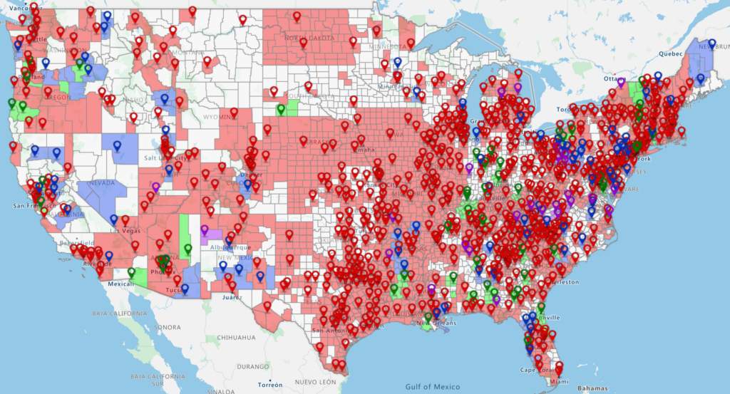
An additional 224 counties are solely served by centers that are not yet members of NCA, but have working relationships with State Chapters. NCA cannot verify the quality of services provided by non-member locations. For an expanded map including these non-members, visit: https://maps.esp.tl/maps/_2020-National-CAC-Coverage-Map-by-County/pages/map.jsp?geoMapId=960119&TENANT_ID=132538
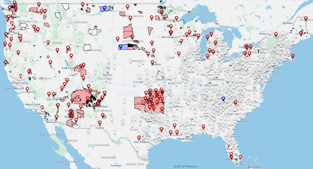
Interactive National Map: 2020 Coverage of Tribal Areas
Click the map below to access an interactive national map in our eSpatial software system that includes CAC coverage of federally recognized tribal areas by the tribe’s relationship to its local CAC(s). Using this map, you can view CAC locations and coverage areas at a national level and zoom to see more details about the CACs in your local area. CAC locations are approximate—for privacy reasons, the exact address is not displayed. For information about how to interpret these maps, please refer to the description below regarding color-coding and other details on the state-specific maps, as the national maps also follow this formatting.
As of December 2020, 141 NCA member Children’s Advocacy Centers served 409 federally recognized tribal communities.